


Chunky Voting District, Newton County, Mississippi
About
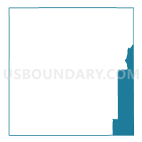
Outline

Summary
| Unique Area Identifier | 606341 |
| Name | Chunky Voting District |
| County | Newton County |
| State | Mississippi |
| Area (square miles) | 44.84 |
| Land Area (square miles) | 44.62 |
| Water Area (square miles) | 0.21 |
| % of Land Area | 99.53 |
| % of Water Area | 0.47 |
| Latitude of the Internal Point | 32.32182270 |
| Longtitude of the Internal Point | -88.94151740 |
Maps


Graphs
Select a template below for downloading or customizing gragh for Chunky Voting District, Newton County, Mississippi


Neighbors
Neighoring Voting District (by Name) Neighboring Voting District on the Map
- Duffee Voting District, Newton County, MS
- Enterprise Voting District, Clarke County, MS
- Fellowship Voting District, Jasper County, MS
- Hickory Voting District, Newton County, MS
- Meehan Voting District, Lauderdale County, MS
- Suqualena Voting District, Lauderdale County, MS
Top 10 Neighboring County Subdivision (by Population) Neighboring County Subdivision on the Map
- District 3, Lauderdale County, MS (16,946)
- District 5, Lauderdale County, MS (16,062)
- District 5, Newton County, MS (4,662)
- District 3, Clarke County, MS (4,301)
- District 2, Newton County, MS (4,178)
- District 2, Jasper County, MS (3,522)
Top 10 Neighboring Place (by Population) Neighboring Place on the Map
Top 10 Neighboring Unified School District (by Population) Neighboring Unified School District on the Map
- Lauderdale County School District, MS (39,113)
- Newton County School District, MS (12,692)
- East Jasper School District, MS (6,922)
- Enterprise School District, MS (3,967)
Top 10 Neighboring State Legislative District Lower Chamber (by Population) Neighboring State Legislative District Lower Chamber on the Map
Top 10 Neighboring State Legislative District Upper Chamber (by Population) Neighboring State Legislative District Upper Chamber on the Map
- State Senate District 31, MS (57,968)
- State Senate District 33, MS (56,120)
- State Senate District 34, MS (55,501)
Top 10 Neighboring 111th Congressional District (by Population) Neighboring 111th Congressional District on the Map
Top 10 Neighboring Census Tract (by Population) Neighboring Census Tract on the Map
- Census Tract 103.02, Lauderdale County, MS (6,622)
- Census Tract 9502, Clarke County, MS (5,969)
- Census Tract 504, Newton County, MS (4,907)
- Census Tract 9501, Jasper County, MS (4,562)
- Census Tract 501, Newton County, MS (3,281)
- Census Tract 104, Lauderdale County, MS (3,028)
Top 10 Neighboring 5-Digit ZIP Code Tabulation Area (by Population) Neighboring 5-Digit ZIP Code Tabulation Area on the Map
- 39307, MS (18,603)
- 39325, MS (5,983)
- 39330, MS (2,746)
- 39332, MS (1,923)
- 39337, MS (1,808)
- 39323, MS (1,290)